18 Sep, 2020
Groundbreaking AI-based Platform Maps And Monitors The Drivers Of California Wildfire
Satellite imagery, sourced from the “eyes in the skies”, is a highly effective way to address many of the sustainability challenges facing Travel & Tourism, such as a deforestation, marine pollution, flooding, water levels, forest encroachment, and much more. If the industry can overcome its myopic obsession with social media, it may realise that technology can serve a far wider and more important purpose.
SAN FRANCISCO, 15 September 2020, PRNewswire – Salo Sciences, Planet and Vibrant Planet are announcing the launch of the California Forest Observatory (forestobservatory.com), a platform powered by artificial intelligence, high resolution satellite imagery and airborne laser data that provides a continuously-updated view of the drivers of wildfire hazard statewide.


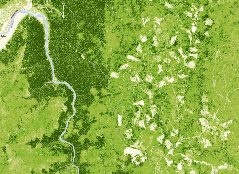
View of tree height (taller trees in darker green) in Redwood National Park, California, and adjacent clearcut forestry on private lands. Map data derived from high-resolution Planet satellite imagery using artificial intelligence.
This tool was built to meet the urgent challenges of the wildfire crisis in California and surrounding states. Fire season has just begun and four of the largest wildfires in state history are burning simultaneously. California has entered an unprecedented wildfire season.
Each year, the frequency and intensity of such catastrophic wildfires increases due to a dangerous combination of historical fire suppression, aging utility infrastructure, rapid wildland-urban interface development and climate change. Wildfire scientists, indigenous communities, and conservation groups all agree we should be prioritizing active management through forest restoration. But the organizations and agencies responsible for forest and fire management—the state, the USFS, private landowners—require better tools to assess and mitigate wildfire risk at scale.
“Governor Newsom’s recently signed Shared Stewardship Agreement between the State of California and the US Forest Service commits to an ambitious 1 million acres of wildfire hazard treatments annually,” said Dr. David Marvin, co-founder of Salo Sciences. “We built the Forest Observatory to support exactly these kinds of large-scale efforts to improve forest management and build resilience to wildfire among our communities and natural resources.”
The Forest Observatory maps forest structure in 3D, producing detailed data on vegetation fuels. These data, combined with weather, topography and infrastructure, will allow land managers to better plan, execute, and monitor hazardous fuels removal. Emergency wildfire operations can use these data to create more realistic wildfire spread models and update evacuation plans. Forest Observatory data are free for non-commercial research use by academics, government agencies and nonprofits.
“The California Forest Observatory uses disruptive technology to quantify forest vegetation structure at the scale and with the precision needed to inform management,” says Dr. John Battles, Professor of Forest Ecology at UC Berkeley. “For researchers, these data provide a valuable and novel resource that supports ongoing efforts to develop strategies that promote the sustainability of California’s forests.”
In addition to revealing potential wildfire drivers, the platform’s tree-level view of both vegetation structure and fuel loads can inform private land management operations, carbon offset markets, regulators, and utility-related vegetation management. Contact: media@forestobservatory.com.


Liked this article? Share it!