24 Oct 2019
5 ways OpenStreetMap can help promote Secondary Tourist Cities in Thailand and ASEAN
Bangkok – The Tourism Authority of Thailand has recently introduced a series of incentives in order to promote Thailand’s “secondary tourist cities” to help alleviate congestion in the prime tourist areas and better balance economic growth in the provinces. As these emerging destinations are in the early stages of tourism development, they will need to enhance to information about their facilities and services for tourists. For example, a search for “hotels for the elderly in Bangkok” vs “hotels for the elderly in Pattani” would find no shortage of information on Bangkok (along with images, videos, maps) and virtually nothing for Pattani.
One way this can be solved is for stakeholders such as governments, universities, businesses and volunteers to help seed this information for use by providing information to various Open Data providers. The data in these providers can then be used in order to create new information packages that can be re-mixed to create information that’s relevant to various niches. With traditional providers, this is not generally possible because licensing restrictions imposed by the various providers as well as copyright laws and treaties significantly reduces what can be done with information available on the internet (see Google Map’s licensing terms).
For example, you want to publish a guide book? Blog? Video presentation? National TV broadcast? You need to read the terms carefully before you can legally do anything. Open Data gives users and machine legal freedom to use this data, allowing the creation of many different types of applications.
What is Open Street Map?
Online maps have become very popular since Google Maps and GPS navigation made it possible for people to go off the beaten path further and wider.
OpenStreetMap (OSM) is a free, editable map of the whole world that’s built by volunteers and released with an open-content license. The main advantage of this map is the underlying data itself, which can then be used for different purposes. For comparison’s sake, it’s like the difference between having graph of the statistics vs the underlying Excel table. If you have the table, you can edit it, run formulas, create new graphs, do exploratory study or even run it through AI and machine learning algorithms. Google Maps will give you the final, polished graph but OpenStreetMap will give you the data.
This post will present 5 ways by which OpenStreetMap can help making secondary cities more accessible in Thailand and right across the ASEAN region.
a. Secondary cities in your language
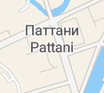
When researching a new destination, it can feel much more comforting to see map information available in your local language. OSM allows you to display data in all the language for features that have been added to the site. This for example is the district of Pattani being displayed on the map in multiple languages via maptiler.com
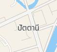
Thai
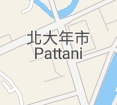
Chinese
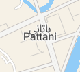
Arabic
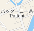
Japanese
Russian
(images above are © MapTiler © OpenStreetMap contributors)
Here is an example of what it can look like when it’s all put together. The following map is that of the Grand Palace area rendered entirely in Turkish:
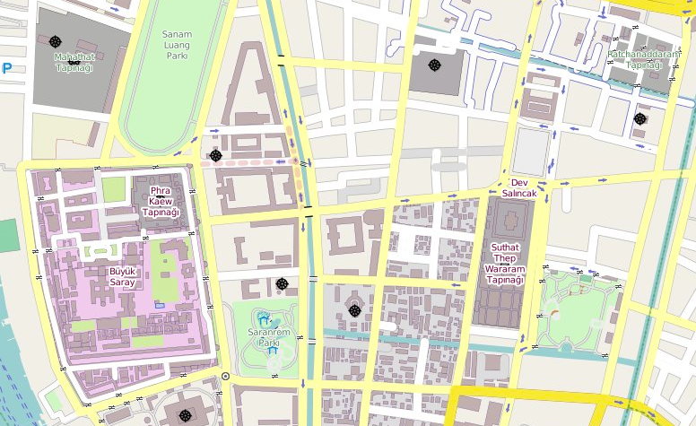
There is no reason why it cannot be in any language that’s available. On top of that, imagery can be used in any media, which is not possible under Google Map’s licensing terms.
b. Maps to suit your use (bicycle, wheel maps)
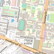
Why do maps have to be a one size fits all affair? The following is a standard map of the Chulalongkorn University area.
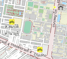
Next is the same map available for cyclists, showing interesting features such as bicycle shops, rain shelters, and pedestrian walkways.
But it doesn’t end there, the map below is of the Sampran Riverside from Wheelmap.org, basically a GPS navigation app for Wheelchairs. It shows in green all the wheelchair-friendly facilities as well as the wheelchair-friendly routes between them.
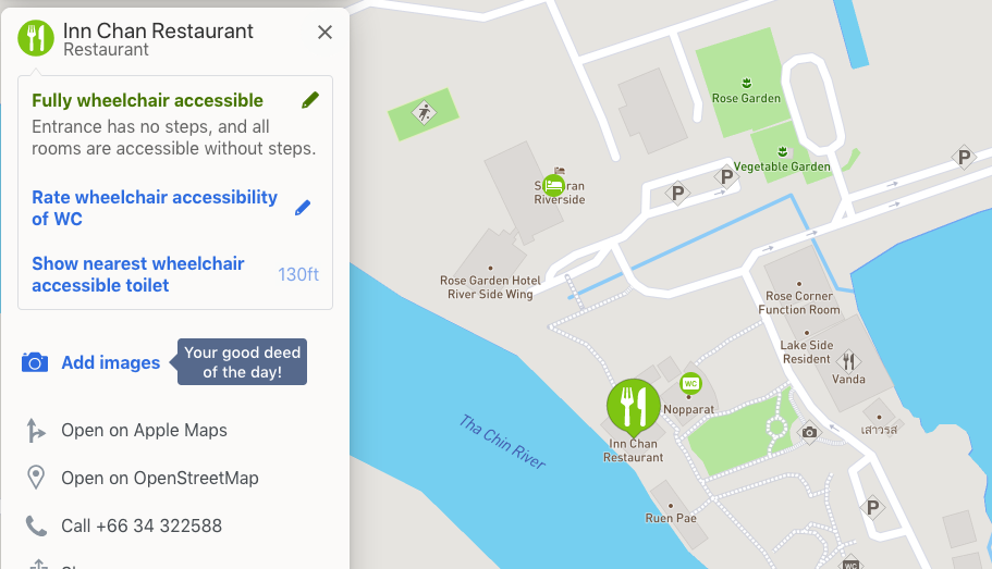
(image from wheelman.org map image is copyright Mapbox and data is copyright OSM Contributors)
This was only possible because data was added in OSM about locations of wheelchair ramps and the accessibility status of the respective facilities. Similar maps can be made, for example, of Halal/Kosher facilities for people on wheelchairs. The possibilities are endless.
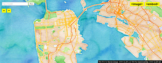
One can also create maps for the sake of beauty, or to suit their brand’s design guidelines, or the local culture, such as the watercolor themed map below from Stamen.
c. Trees and other local niches
People look for different things on maps. Some people even want to find old or rare trees, others like historic or religious sites. Young parents may want to look for playgrounds near toilets with diaper-changing facilities.
In Austria, the authorities have added data of their Trees to OpenStreetMap (represented by the green dots). You can also see other important facilities such as restaurants, toilets, walking paths, bridges, and other useful amenities.
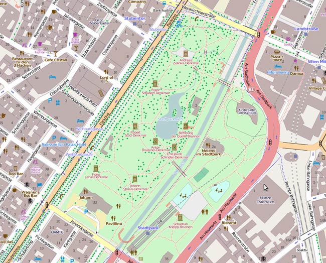
(source: data.gv.at)
The community themselves can be part of of this experience. Narathiwat Province, for example, is known for its beautiful Bauhinia aureifolia trees and so the community can take part in mapping those. Shrines, places of worship, local museums and other points of interests can be mapped by the community to show off their best features to the world.
d. Geospatial analysis
Supposing you’re a hotel developer and you would like to find the perfect spot for your new hotel. It has to be near a railway station, near convenience shops, near a park with children’s playground, near a coffee-shop and at least 200 meters away from the main road. How would you do it?
Definitely this is not possible with the somewhat pre-processed information available from Google. However from OpenStreetMap as long as all the data is available, it’s very much possible to use software like QGIS to help find areas that meets these criteria.
In case you’re wondering, the areas marked with deep purple in the following image meets those criteria in Bangkok:
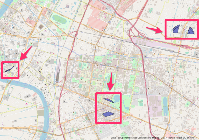
The analysis above a few decades ago would have cost tens of thousands of dollars. Now since all the tools and data are free, this levels the playing field between large and small players, allowing the smaller developers to setup niche operations using the data they have. In fact, here’s a tutorial I wrote on how to do it (in Thai): https://archive.mishari.net/th/2018/01/perfect-home/
Grab is also doing geospatial analysis by using OSM data for calculating the fare between the source and destination as well as the blue line that gives route previews:
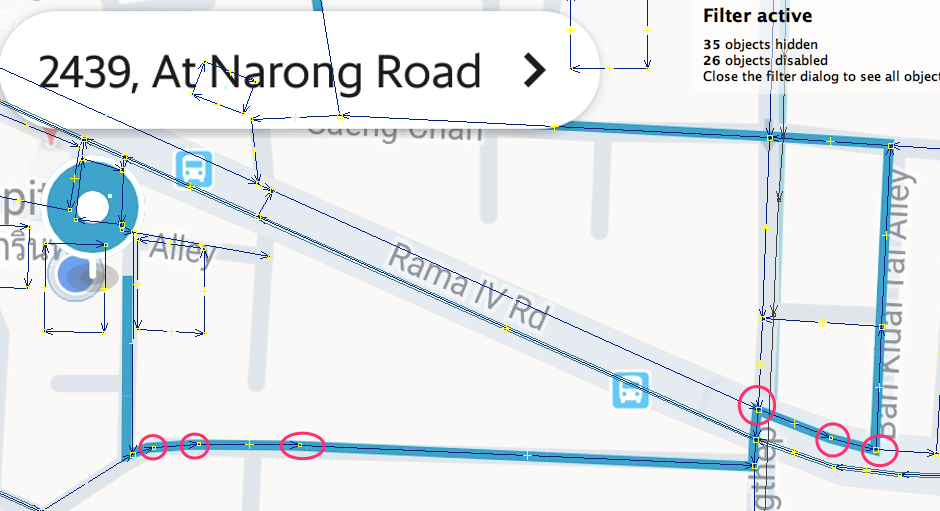
(image from the Grab application with blue lines aligned with OSM data.)
The better the data, the easier it is for new entries into this sector to create services to cater to secondary cities.
e. Democratization of Technology
Often, the large map providers hold disproportionate power over the technology and its uses. Recently, Google changing its pricing strategy forced many websites to go offline because they could not afford to pay Google for their mapping services.
Since the Thai Government, the TAT and other stakeholders are promoting secondary cities, control over content should be in the hands of the stakeholders and the local communities, not large data providers.
With this, OpenStreetMap can play a part in furthering the attractiveness of the secondary cities by opening the door for digital facilities which are as comprehensive, and in some respects better, as their primary counterparts.
How does one get involved?
The best way is to first figure out what you want to map. It can be anything: roads, wheelchair ramp, post boxes, trees etc. the layout of your hotel or favorite attraction. Go to the Learn OSM website and start learning how to use the tools. You can also get help from the community on the Thai forum, Facebook Group. You’re also welcome to drop me an email.
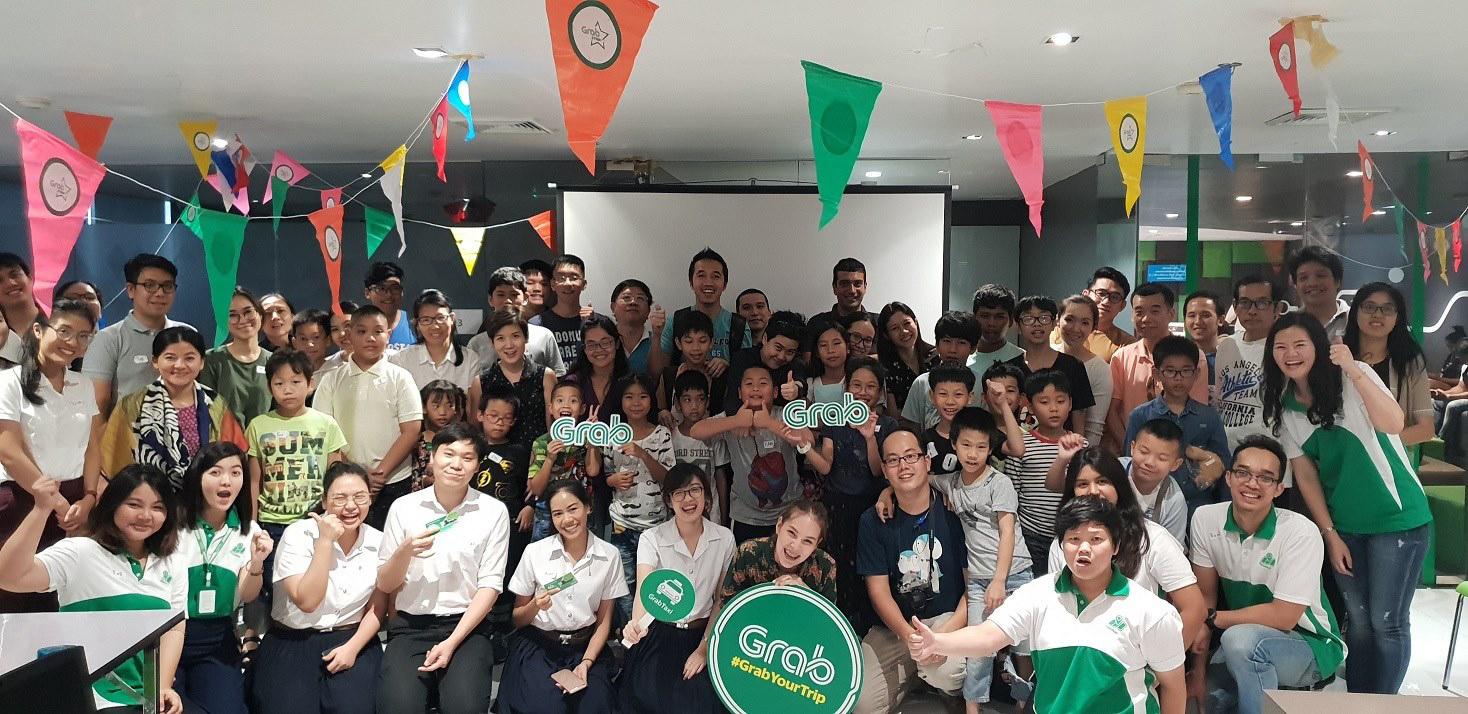
Lastly, if you wish to organize an event to add data to OSM for your employees, local school, or community, you’re most welcome to do so. Grab for example has in the past organized mapping parties (Mapathons), in collaboration with the author, that’s plenty of fun for all involved.
Mishari Muqbil is the lead organizer of Open Tech Summit Thailand, a conference dedicated to Open Technology and Open Culture. He helps corporations and teams use Open Technology and Open Collaborative models to break down barriers, drive innovation, reduce operational risks, and increase profitability.
